Conservation Projects of the Mahoosuc Initiative
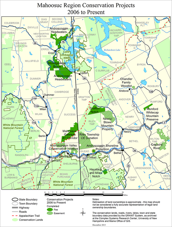
Between 2006-2014, the Mahoosuc Initiative's partner organizations achieved 40,000 new acres of land conservation through fee purchase (solid bright green) and easements (bright green stripes).
New Hampshire
Thirteen Mile Woods
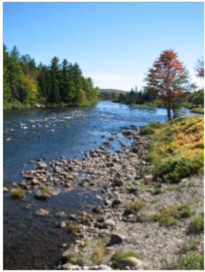 photo by Larry Ely
Even before the Mahoosuc Initiative got underway, the town of Errol took steps to protect its valued local resources by establishing a 7,100-acre town forest along the Androscoggin River as it flows south from town. The Thirteen Mile Woods were long considered a scenic gem along state Route 16, and a core group of local residents wanted to see timber management and recreation uses continue. The Trust for Public Land assisted the town by purchasing and holding the parcel while town financing was worked out, and the land was conveyed to a special management committee of local citizens in 2005.
In more recent years, the Trust for Public Land (TPL) has worked with landowner Plum Creek and the Umbagog National Wildlife Refuge to protect significant land and resources in the upper headwaters of the Androscoggin River. To-date 7,400 acres have been added to Umbagog NWR (2,920 acres in 2011 and 4,532 acres in 2012), and 984 acres surrounding Greenough and Little Greenough Ponds have become a new State Wildlife Management Area. An additional 23,000 acres of working forest conservation easements are planned.
In more recent years, the Trust for Public Land (TPL) has worked with landowner Plum Creek and the Umbagog National Wildlife Refuge to protect significant land and resources in the upper headwaters of the Androscoggin River. To-date 7,400 acres have been added to Umbagog NWR (2,920 acres in 2011 and 4,532 acres in 2012), and 984 acres surrounding Greenough and Little Greenough Ponds have become a new State Wildlife Management Area. An additional 23,000 acres of working forest conservation easements are planned.
Umbagog National Wildlife Refuge
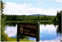 photo by Open Space Institute
The Umbagog National Wildlife Refuge was first established in 1992 to protect the extensive wetlands around Lake Umbagog and the wildlife and migratory birds that depend on them. The refuge brings thousands of visitors to the area each year, many of whom stay in private or state campgrounds and support local businesses like the regionally-famous L.L. Cote outdoor equipment store in Errol. A Comprehensive Conservation Plan, completed in 2007, acknowledged the importance of protecting uplands that drain into the lake, rivers and wetlands, and resulted in approval for 47,807 additional refuge acres - 56% as fee acquisition and 44% as conservation easements.
Mount Jasper
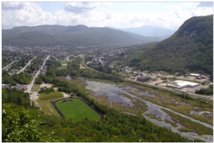 photo by White Mountain Ridgerunners
Further south, the City of Berlin owns a 203-acre parcel that includes Mount Jasper, a peak with spectacular views of the city and surrounding region. The area has a long history of public use, dating back to Abenaki quarrying of rhyolite as long as 9,000 years ago. Today the parcel holds a number of high-use foot-traffic trails, as well as two designated snowmobile trails. While this property has been owned by the City for a number of years, there was no management plan or protocol for management. Led by a representative of the Appalachian Mountain Club (and former Berlin resident), the City began the process of developing a management plan in 2012, and the plan is now nearly finished. A report on ecological, geological and cultural values of the property provided background for the planning effort.
Shelburne, NH - Androscoggin Valley
The Conservation Fund’s Androscoggin Valley Conservation Initiative works with landowners in Shelburne, NH to protect private lands in this border region of the Androscoggin River valley. The signature project was protection of the historic Philbrook Farm Inn, built in 1834 and operated as an inn since 1861, along with several neighboring properties totaling 1,000 acres and a mile of Androscoggin River frontage. Since that impressive start, this project has now protected a total of 2,370 acres, and is in the process of adding 260 more acres of easements on private land.
Appalachian Trail & Success Township
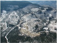 photo by Larry Ely
The Fund will transfer 300+ acres of its Bald Cap Peak property bordering the Appalachian Trail (AT), including the summit of Bald Cap Peak and the outflow of Page Pond, to the National Park Service. The remaining 900 acres will be conserved timberland. The AT corridor through Shelburne and Success now totals approximately 8,000 acres. Recent expansions of 4,800 acres protected by The Fund in 2010 include 6 miles of the AT and provide access to three connector trails and trailheads for day hikes. The AT lands are owned by the National Park Service and managed by the US Forest Service.
The Conservation Fund has recently received $5.7 million from the USDA Forest Legacy Program to conserve, through conservation easements, 15,200 acres in Success Township NH. This includes 9,000 acres purchased by The Fund to ensure its conservation for working forest and diverse public recreation. The lands will be managed as timberlands and remain in private ownership. These lands abut the National Appalachian Scenic Trail for 6 miles, providing the view along 12 miles of the AT.
The Conservation Fund has recently received $5.7 million from the USDA Forest Legacy Program to conserve, through conservation easements, 15,200 acres in Success Township NH. This includes 9,000 acres purchased by The Fund to ensure its conservation for working forest and diverse public recreation. The lands will be managed as timberlands and remain in private ownership. These lands abut the National Appalachian Scenic Trail for 6 miles, providing the view along 12 miles of the AT.
Maine
Mahoosuc Land Trust
The Mahoosuc Land Trust has worked with landowners in the Mahoosucs and surrounding region to protect 1,370 acres through fee ownership and 5,556 acres through conservation easements. MLT also worked with the state of Maine to add the 386-acre Frenchman’s Hole parcel to the Bureau of Parks and Lands Mahoosuc Unit.
Bingham Forest
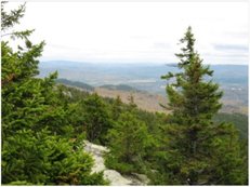 photo by Mahoosuc Pathways
The land that became Bethel’s Bingham Town Forest was first conveyed to the Bethel Water Company by William Bingham II in 1925. 2,358 acres of land along the Bethel/Newry town line protected Bethel’s water supply - Chapman Brook. The brook continued to provide drinking water until 2007, when damage from severe flooding led the town to switch to ground wells. Since the original conditions of the donation no longer held, the land was formally conveyed to the town of Bethel in 2010, with the stipulation that it be managed to protect future water use if needed. The town plans to develop low-impact recreational trails and conduct careful timber harvesting, consistent with the primary water protection purpose.
